


Cape Town’s dams have been filling up throughout the rainy season and more rain is coming our way from Thursday. The rain is exactly what we need to push the average dam levels past the 60% mark. A reading yesterday placed the Western Cape dam levels at 53.3% full.
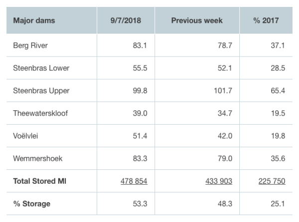
Most dams have almost doubled their capacity since 2017, which is a good sign for the summer season. A year ago, our dams were 25.1% full and now they are 53.3%.
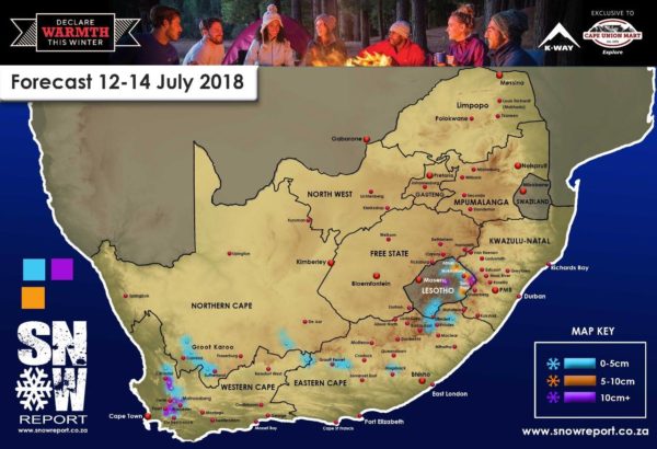
A cold front is expect to pass through the province on Thursday but temperatures won’t drop too low. Snowfall is anticipated in some high-lying areas of the Western Cape.
On Monday, Snow Report said in a Facebook post: “It is not going to be as big as last weeks falls, with expected snow on the Matroosberg Peak around 5cm – 7cm and 6cm to 8cm on the Cederberg. A bit further south, the Sneeukop at Wellington could get a bit more, between 18cm to 28cm.”
More snow is also expected in the Northern Cape, the Eastern Cape and Lesotho. And in KwaZulu-Natal, the Drakensberg range can expect snowfall by Saturday morning.
“As this forecast is quite far in advance, it is likely to change over the next few days, especially the predictions for the Eastern Cape, Lesotho and the KZN Drakensberg. We will post updated forecasts as we see changes in the conditions, so please check back daily,” Snow Report said.
Last week, many parts of the Western Cape experienced a beautiful blanketing of snow, with the frosty flakes even landing on the Mother City’s pride and joy, Table Mountain. The rain cascading off the mountain after the rain was a beautiful sight too.
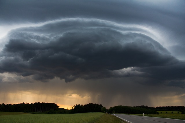
Picture: Pixabay
