


There is no better way to end off a short-work week than with a flurry of snow. The South African Weather Service has predicated a dusting from Friday evening all the way through to to Saturday night for several high-lying areas in the Western Cape.
“We are expecting snow to fall from Friday late afternoon through to Saturday on the western high grounds of the province. Snow is expected on the Cederberg Mountains, all the way up to Franschhoek. There is even some expected to fall in Sutherland and Citrusdal. And on Saturday morning there will be a dusting in the Swartberg and Langeberg Mountains and even some on the Outeniqua range,” said Kate Turner, Senior Forecaster at the Cape Town Weather Service.
She predicts that there could be anything between 1 – 4cm. “It won’t be a heavy snowfall, and it will probably melt quickly,” said Turner.
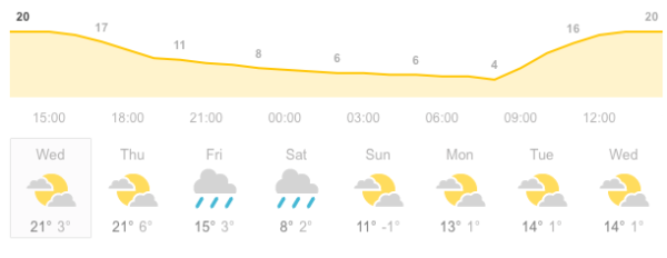
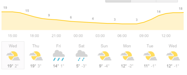
Temperatures are expected to drop below freezing in some areas like the Hex River Mountains and Franschhoek. With 90% rainfall expected over most of the Western Cape on Friday and temperatures dropping to -4°C, snow is eminent.
Matroosberg Reserve has put out a snow alert for falls on Friday. If you plan on going out to catch a glimpse of the snow, they warned that admission to higher lying areas is weather permitting because safety is their priority.
You can contact them at 023 3122282 or 0731940885 or email [email protected] to find out more information.
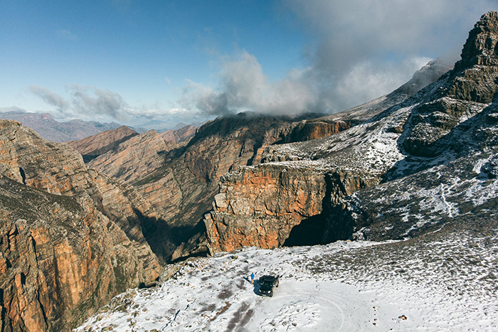
Picture: Kevin Sawyer
