


What weather forecasters are calling one of the most eventful winter weekends in Southern Africa in many years is expected to make landfall in the Western Cape on Thursday, July 9. The mammoth cold front is is expected to bring heavy rains and even snow in high-lying areas.
The entire weather community in South Africa has eyes on the mammoth #coldfront developing in the South Atlantic (blue) this system, arriving Thursday, promises to bring heavy rains and widespread #snow to a great deal of SA and even #namibia if the system stays on track. pic.twitter.com/zqDIkga0QZ
— SA Weather?️sawx.co.za (@sawx_sa_weather) July 6, 2020
A simulation of what we can expect from the #coldfront arriving late Thursday early Friday into the weekend. pic.twitter.com/wHX796W6eV
— SA Weather?️sawx.co.za (@sawx_sa_weather) July 8, 2020
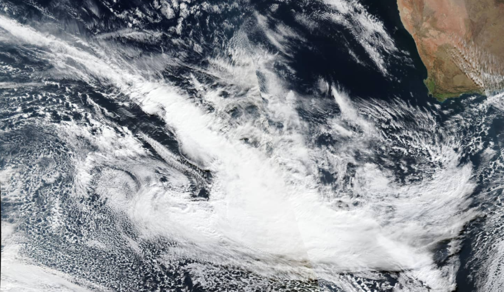
Early morning InfraRed #coldfront monitor satellite image from Meteosat 0 degree. The cold front expected to arrive late Thur/early Fri is looking well defined and still well on track. A second front also arriving Sunday/Monday and a region out of central S.America worth watching pic.twitter.com/PuyYJIWJVt
— SA Weather?️sawx.co.za (@sawx_sa_weather) July 8, 2020
Matroosberg Nature Reserve is expecting especially low temperatures through the weekend and into the beginning of next week. Temperatures in the area will dip as low as -9°C on Saturday, July 11. Tuesday, July 14 will be particularly cold as well reaching a low of -8°C according to Weather.com.
A second cold front on Tuesday is expected to extend the cold temperatures further into next week, and bring more snow in high-lying areas as it makes landfall.

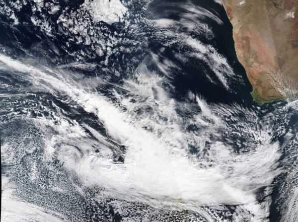
Storm Report SA says the massive cold front en route to Cape Town is still strengthening as it approaches the province.
The Cape Town Weather Office has also issued a severe weather warning.
“Strong north-westerly winds (60-75km per hour) are expected over the Western Cape on Thursday [July 9] but strong gale (80-100km per hour) wind is expected over the Central Karoo, Little Karoo, Cape Winelands, Overberg and coastal regions between Cape Columbine and Cape Agulhas of the Western Cape spreading to Plettenberg Bay by Thursday evening and subside by Friday morning [July 10],” they said.
Make sure properties are secure and all loose materials around dwellings are tied down or brought inside before the approaching storm. Flood warnings have also been issued.
The Disaster Risk Management Centre has been advised by the South African Weather Service of the following weather warnings :
A well-developed cold front is approaching the country from the west making landfall on Thursday afternoon, July 9, 2020. Ahead of the cold front, strong to gale force north-westerly winds of 60-74km/h with gusts up to 100km/h , are expected in places across the provincial interior into the evening.
The gale force winds are also expected along the maritime areas of the south-western Cape coast between Saldanha Bay and Cape Agulhas on Thursday, spreading to Alexander Bay by late evening.
The front is expected to produce significant rainfall over the western areas of the Western Cape as it makes landfall on Thursday afternoon, with projected rainfall accumulations of 15 to 30mm.
The bulk of the rain will fall during the evening through the night, resulting in rainfall amounts of 45 to 50mm in the south-western mountainous areas of the province.
All City services and external agencies will be on standby to deal with the predicted adverse weather conditions.
Residents are reminded to please log any weather-related emergencies and/or impacts to the City’s Public Emergency Communication Centre on 021 480 7700 from a cellphone or 107 from a landline.
Picture: Storm Report SA
