


South Africa was plunged into the depths of winter this week, and several provinces experience heavy rainfall and even snow. A strong cold front stormed into the Cape on Wednesday [June 10], bringing sheeting rain, hail and howling winds.
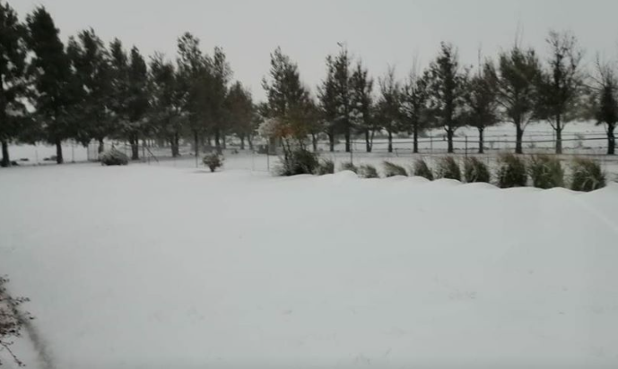
The Western Cape was blanketed with beautiful white snow in some high-lying regions. According to weather forecaster Mike Berridge, sub-freezing temperatures can be expected across South Africa between Thursday, June 11 and Friday, June 12.
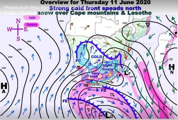
The cold front that made landfall in the Cape will move eastward to cross Windhoek, Namibia, as well as the south-western half of Botswana, Gauteng and Mpumalanga.
“Apart from the rain in west Cape, clouds and showers will develop across the central Cape regions during the day,” Berridge said. “The front will be further enforced by the arrival of colder air from “FC” and finally “FD” which will enable snow across most of the central Cape mountains and southern Drakensberg. The driving force of the cold winds by tomorrow evening will be a strong pressure gradient from the Atlantic High “HA” which will advance in the direction of the bold grey arrow. This will introduce very dry air and will lead to severe overnight frosts.”
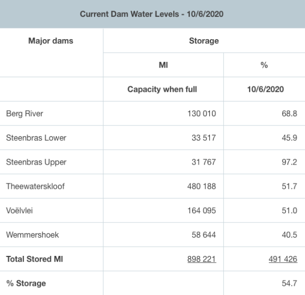
Cape Town’s feeder dam levels have increased by 0.1% in the past week. Hopefully the dams will fill up as more rains fall. On Wednesday dam levels were 54.7% full.
Temperatures in the Mother City will remain low this week – the minimum temperature is 9°C between Thursday to Saturday.
See how South Africa transformed into a wintery snowscape:
Picture: Tossie Muller/Storm Report SA
