


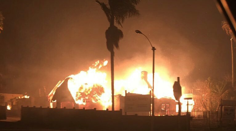
The fire that ravaged the coastal town of Knysna last year has been called “one of the worst fire disasters” in the country’s history. Information from South African Weather Services suggests that the fire was started by a lightning strike in June last year.
A year after the devastating blaze, the residents of Knysna are still working to rebuild their lives and the tarnished natural environment around them. The impact of the fire has had an immensely negative effect on the Garden Route’s natural vegetation, allowing alien vegetation to run amok.
The Eden Festival of Action will take place over the next three weeks, where indigenous plant species will be replanted in the Knysna area, alien vegetation will be removed and catchment management will be well underway.
The re-greening festival will encompass two weeks of locals partaking in community environmental and social initiatives which will teach them how to best prepare themselves against a future natural disaster. The final week will see visitors engaged in activities to help reestablish the fauna and flora of Knysna.
Eco-bricks (bricks made of entirely natural and sustainable materials) will also be created and used to brighten up local schools.
The Council for Scientific and Industrial Research (CSIR) released a report about the Knysna fire on Thursday, which dissects the most likely sequence of events that may have casused the fire. This report draws its conclusions by using satellite images, drone video footage, weather and lightning data to investigate how the fire spread in its first 45 minutes.
Information from South African Weather Services suggest that a lightning strike may be the cause of the fire.
Two fires started on June 7, 2017 – one in Elandskraal and one in Kruisfontein – with the CSIR focusing only on the Elandskraal fire, where a satellite first detected a patch of brown, dying vegetation on 29 March.
Although the Elandskraal fire detected on March 29, 2017, the patch of dying vegetation lay smoldering. A berg wind that blew across the smoldering patch provided sufficient oxygen to cause a flare up. This flare up raged into the devastating Knysna fire on 7 June.
The CSIR used commercial satellite images as well as data from the International Charter on Space and Major Disasters, the National Aeronautics and Space Administration (NASA) and European Space Agency (ESA).
“Following reviews by local and international experts‚ the scientific report was submitted to fire managers‚ relevant stakeholders‚ such as the Southern Cape Fire Protection Association‚ the Western Cape’s Provincial Disaster Management Centre‚ Knysna municipality‚ International Charter on Space and Major Disasters and is now available to the general public,” the CSIR said.
Picture: Twitter
