


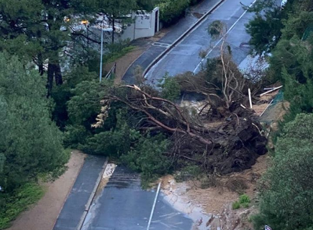
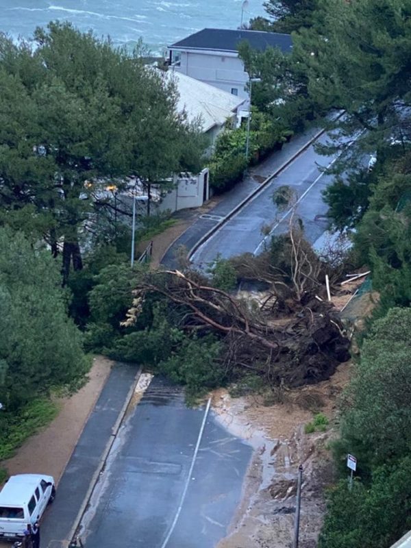
Motorists are advised to avoid Kloof Road and make use of alternative routes. A large tree has uprooted and is blocking the road. This is a result of localised flooding in the area along with strong winds from the cold front.
A severe weather warning has been issued for the Western Cape with more flooding, heavy rains, strong winds and snow expected over the weekend.
Various informal settlements across the city have been affected by heavy rains experienced last night. According to Disaster Risk Management, officials will be making assessments of formal settlements on Friday, July 10.
A tree was also uprooted in the Atlantis Industrial area, damaging a vehicle. Power outages are being experienced in Mitchell’s Plain, Claremont, Philippi, Lotus River and Retreat.
Many roadways across the city have been flooded and Transport is attempting to clearing roadways as quickly as possible.
The NSRI has advised locals to steer clear of coastal areas as rough seas and high waves are expected.
“With a second of three cold fronts forecast by the SA Weather Service to land along the Western Cape coastline late on Friday and into Saturday and with the first of these three cold fronts that has now moved further along the Western Cape coastline towards the Eastern Cape coastline the National Sea Rescue Institute (NSRI) is appealing for public caution with high, rough seas and gale force winds being experienced along the coastal regions of South Africa lasting into Monday and possibly into Tuesday,” said the NSRI in a statement.
NSRI responded to three incidents related to the severe weather during Thursday in Knysna, Millers Point and Mossel Bay.
A third large cold front forecast for Monday is currently being monitored by the SA Weather Service (SAWS).
There is a concern that the lulls being experienced in between these cold fronts may give a false impression of improving conditions.
Localised flooding, storm surges, gale force winds and high seas are some of the winter weather phenomena currently being experienced from these cold fronts. Gale force winds and high seas are being experienced along the coast and the forecast cold fronts may result in damage to infrastructure and beach erosion. Disruption to Port and small harbour activities can be expected.
“With storms and high seas along coastal regions our concern is for smaller vessels at sea which may have difficulty navigating through the conditions. We are also appealing to boaters, paddlers, beach goers, surfers, coastal hikers, anglers and the public to be cautious around the coastline and to follow South African Weather Service (SAWS) forecasts,” said NSRI CEO, Dr Cleeve Robertson, on Friday. We urge beach goers and coastal hikers to stay away from the coastline, as dangerous waves or surges may catch them off-guard and could potentially sweep them off the rocks along the shoreline,” added Robertson.
All City services and external agencies will be on standby to deal with the predicted adverse weather conditions.
Residents are reminded to please log any weather-related emergencies and/or impacts to the City’s Public Emergency Communication Centre on 021 480 7700 from a cellphone or 107 from a landline.
Also read: NSRI warns to steer clear of coast ahead of stormy weather
Picture: Facebook/Nicola Jowell
