


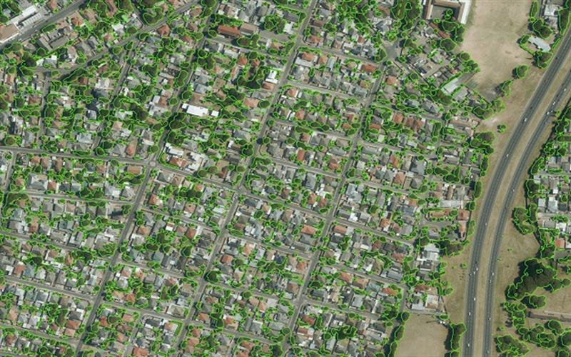
The City of Cape Town has completed South Africa’s first ever tree mapping project. This project identified all the trees within the city, providing clear data on the development of the city’s urban forest.
Cape Town has not quite reached the definition of an urban forest according to the United Nations. Rather than the required continuous 10% of tree canopy cover required, the city currently has 7%.
They initiated this project last year to help identify tree species, location, characteristics, images, maintenance history, risk assessment and further maintenance and management needs.
“This is an exciting project and we are confident that the data gathered during the project will assist the City’s Recreation and Parks Department to effectively manage the City’s trees and to plant future trees in areas where it is most needed,” said Mayoral Committee Member for Community Services and Health, Councillor Zahid Badroodien in a statement.
Using infrared images and light detection and ranging (LiDAR) data, the City were able to extract this key information.
“The value of trees cannot be overestimated. While they assist in providing cleaner air, they also offer environmental protection against erosion and acting as noise buffers. Let us all care for our trees so that future generations also have access to beautiful parks and open spaces,” said Badroodien.
Picture: City of Cape Town
