


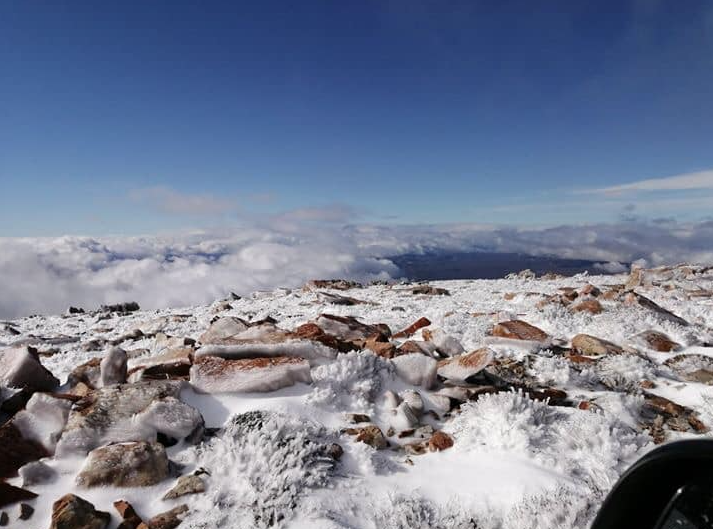
The Matroosberg area is expected to receive a fresh dusting of glittering snow in the next few days, with increasingly strong winds bringing in more swirls of white.

The last dusting of snow fell more than a week ago, and the freezing temperatures are predicted to bring in a fresh flurry of snowflakes. For those visiting the reserve, it means more days of building snowmen and frolicking in the icy expanses.
According to Snowforecast.com, light winds can be expected from the north-east this evening, while gale-force winds will bring temperatures down on Thursday evening.
Freeze-thaw temperatures are also predicted to set in – Saturday evening will have a maximum temperature of 7°C, while Sunday will bring temperatures as low as -1°C. The first light sprinkling of snow is predicted to touch down on Monday evening.
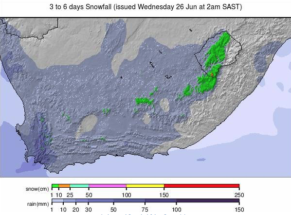
According to Stella Nake, a forecaster from the South African Weather Service’s (SAWS) Cape Town office, snow is also predicted to fall over the Western Highlands.
Areas such as Ceres, Worcester and Sutherland are also to receive a little snow, predicted to amount to approximately one millimetre.
Cape Town is also predicted to receive seven days of rain over the next two weeks.

The recent drought crisis caused a mindset shift in Capetonians, who now rejoice when rain is predicted. The recent winter rains have bolstered the previously-struggling dam levels to reach an overall average capacity of 50.2%.
Picture: Matroosberg Private Nature Reserve
Source:  (Snowforecast.com)
