


Cape Town is in for a rainy week, with two more days of showers on the cards starting from Tuesday. Chilly weather is also on the forecast so residents are cautioned to stay cosy.
While Monday has proven to be a windy, rainy and somewhat stormy day, Tuesday, May 26 promises scattered showers and even lower temperatures according to Weather.com.
According to Mike Berridge, the rest of your Monday may look like this:
“HA” will extend a strong high ridge eastward overland to enhance the very cold wind behind the front to become southerly and very dry. This will lead to severe frosts overnight Tuesday – Wednesday,” says Berridge.
Tuesday will bring showers throughout the day paired with a high of 14°C and a chilly low of 9°C. Wednesday, May 27 will still be cool with a high of 16°C and a low of 12°C, but no rain is on the forecast.
On Thursday, May 28, the rain will return. A high of 16°C with a low of 14°C is on the cards, as well as what may be heavy rains throughout the day.
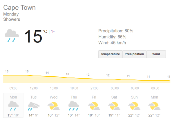
From Friday, May 29, temperatures will get warmer up until Monday, June 1. Cloudy weather and slightly warmer temperatures are in store during this time.
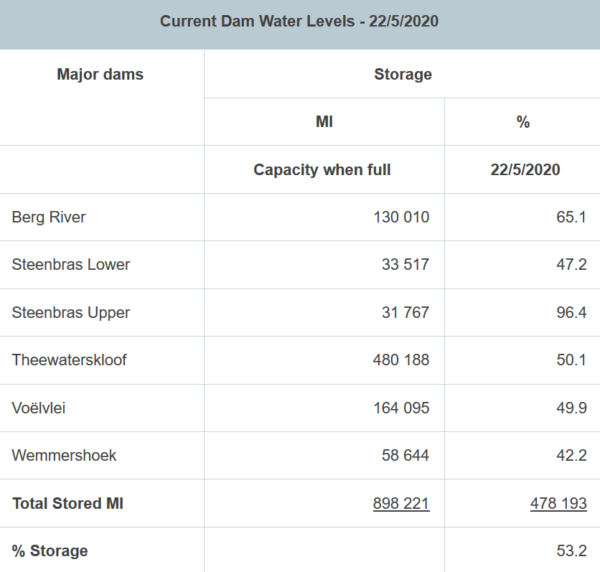
While we look forward to a more rainy week than usual, dam levels are looking up at 53.2% storage with the rainy weather ahead sure to bolster the levels.
Pictures: Pexels/The City of Cape Town, Weather.com
