
While calm and dry weather envelops some parts of the country over the next two days, two cold fronts will make landfall in the Western Cape this weekend, according to the South African Weather Service (SAWS).
The Western Cape can expect windy conditions on Saturday, spreading eastwards to most of the province’s interior during Sunday and Monday.
Also read: SAWS predicts intense heat and flooding this summer as El Niño hits SA
SAWS said the first cold front is expected to make landfall by Saturday late evening with the second cold front coming in on Sunday late afternoon.
As a result, the weather service issued a series of impact-based weather warnings for strong winds, rough seas and very cold conditions for parts of the Western and Northern Cape provinces from Saturday onward.
‘These conditions are most likely going to spread to the central interior during early next week,’ added SAWS.
Additionally, the possibility of snowfall over the mountains of the Western Cape is high and is predicted to occur on Sunday night into Monday.
The following impact-based warnings were issued:
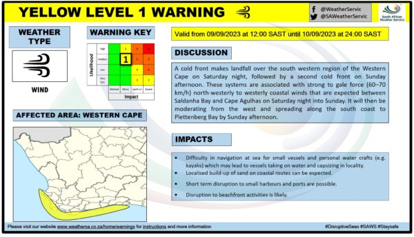
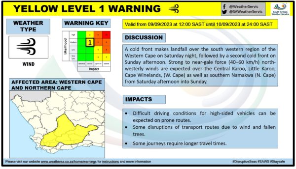
Yellow level 1: Wind
SAWS explained that the two cold fronts are associated with strong to near-gale (40 to 60kph) and gale force (60 to 70kph) north-westerly to westerly winds.
These windy conditions are expected between Saldanha Bay, Cape Agulhas ad adjacent coastal towns on Saturday night into Sunday, before moderating from the west and spreading along the south coast to Plettenberg Bay by Sunday afternoon.
Additionally, SAWS warned that interior winds may result in difficult driving conditions over the Cape Winelands from Saturday afternoon into Sunday.
The warnings are valid from Saturday, 12pm, until midnight on Sunday.
Explore Cape Town and its surroundings with these incredible deals on cars for under 100k. Find car listings here.
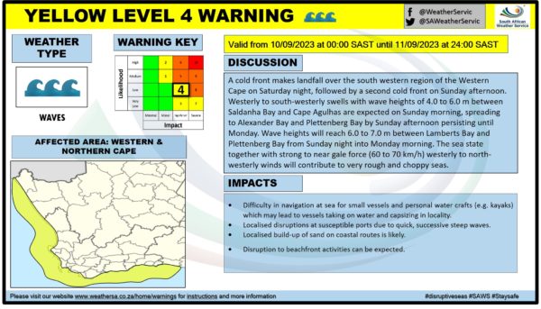
Yellow level 4: Waves
A warning for waves was also issued as westerly to south-westerly swells with wave heights of 4 to 6 metres are expected between Saldanha Bay and Cape Agulhas on Sunday morning.
These wave swells will then spread to Alexander Bay and Plettenberg Bay by Sunday afternoon and persist until Monday.
Between Lamberts Bay and Plettenberg Bay, wave heights will reach 6 to 7 metres from Sunday night into Monday morning.
SAWS added that the sea state in combination with strong to near gale force westerly to north-westerly winds will contribute to very rough and choppy seas.
The warning is valid from Sunday, 12am, until midnight on Monday.
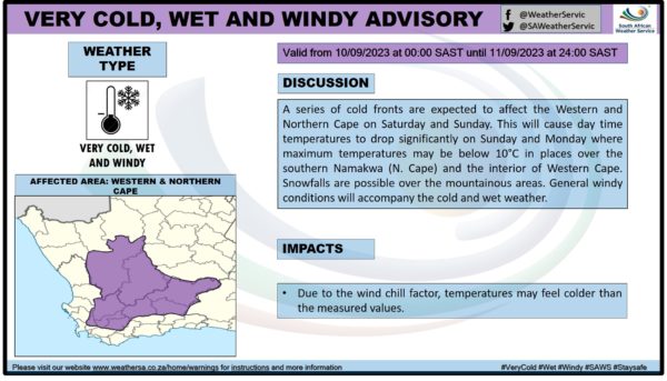
Lastly, an advisory for very cold, wet and windy conditions were issued by the weather service for the interior of the Western Cape from Sunday into Monday.
SAWS warned that the two cold fronts ‘will cause day time temperatures to drop significantly on Sunday and Monday where maximum temperatures may be below 10ºC’ in places over the interior of the Western Cape.
General windy conditions will accompany the cold fronts and mountainous areas may experience some snowfall.
The advisory is valid from Sunday, 12am, until midnight on Monday.
Cape {town} Etc discount: Looking for things to do in the city, at half the price? Get exclusive offers here.
Also read:
Timber! City’s tree emergency teams reflect on a record-breaking season
Picture: Matthew Henry / Unsplash