Despite the forecasted sunshine later this week, more cold, wet and windy conditions are on the cards for parts of the Western and Northern Cape, according to the South African Weather Service (SAWS).
Also read: Yellow level 1, Red level 10: What do weather warnings mean?
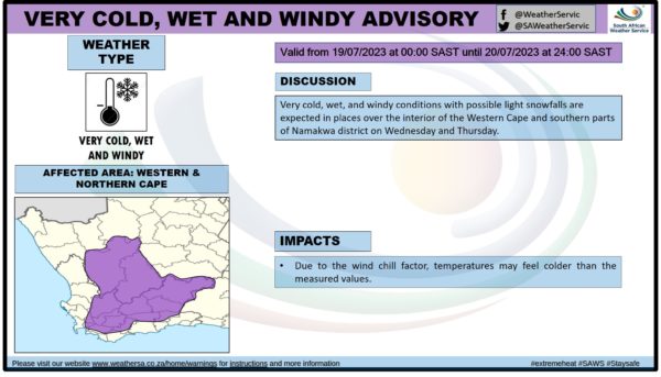
According to its latest advisory, possible light snowfall in places over the interior of the Western Cape and southern parts of Namakwa district are expected in addition to very cold, wet and windy conditions.
The advisory is valid from midnight on Wednesday, 19 July, until 11:59pm on Thursday, 20 July.
SAWS advises that temperatures may feel colder than the measured values as a result of the wind chill factor.
Take a look:
Cape {town} Etc discount: Warm up your body with a 30-minute virtual reality gaming experience in Sea Point for R93 (valued at R155). Get it here.
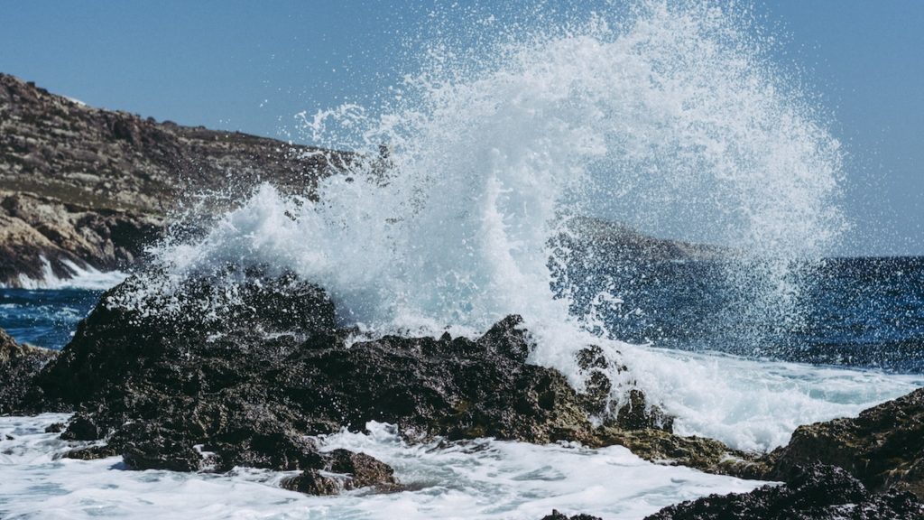
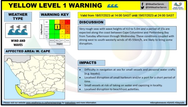
Additionally, SAWS has issued a Yellow level 1 warning for strong winds and waves expected along the coast between Cape Columbine and Plettenberg Bay from Tuesday afternoon through Wednesday.
‘Very rough seas with wave heights of four to 5 metres and a period of 15 seconds are expected… These conditions coupled with strong west to south-westerly winds of 45 to 55kph, are likely to bring some disruption,’ said the weather service.
The warning is valid from 2pm on Tuesday, 18 July, until 11:59pm on Wednesday, 19 July.
Possible impacts include:
- Difficulty navigating small vessels and personal water crafts at sea
- Localised disruption of small harbours and/or ports
- Risk of taking on water and capsizing in locality for small vessels
- Localised disruptions to beachfront activities.
Take a look:
Are you searching for a safe and reliable vehicle that fits your needs and your budget? Find car listings for under R100 000 here.
Also read:
Cape Town’s Queen of the Cold takes on Matroosberg with friends
Picture: Janosch Lino / Unsplash