


Rainy weather in the Mother City is showing no signs of going away any time soon, with more showers on the cards for next week.
According to popular forecaster Mike Berridge, mild days are ahead before we head into rainy weather again from Tuesday, June 9.
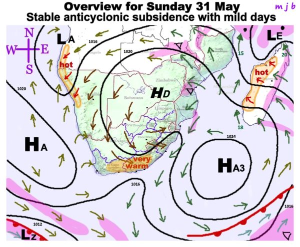
“The counter clock-wise wind circulation around the High complex ‘HD’ and ‘HA3’ is feeding some moisture into the far northern eastern regions where clouds will form in southern and central Mozambique, Malawi, Zambia, northern-eastern Angola, and the Lowvelds of Limpopo and Mpumalanga at first. Places eligible for showers are shaded pink. The same anti-cyclonic wind circulation is generating warm winds with sunny skies in the south and south-east Cape. These berg winds will persist for the next 3 days until about Wednesday,”says Berridge.
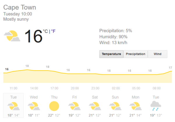
Before the rain, however, Cape Town is in for some dry days ahead with plenty of wind to keep the fresh air circulating.
Ahead of the cooler days next week, the Cape will be heating up slightly this week. Wednesday, June 3 will be a cloudy day with a high of 18°C and a low of 11°C. Thursday, June 4 will bring sunny weather and the warmest day of the week at a 22°C high with a low of 12°C.
From Friday, June 5 to Monday, June 8, temperatures will be similar ranging from highs of 21°C to lows of 12°C and partly cloudy conditions.
News on when the Western Cape will receive its next snowfall is not available yet but with temperatures dipping next week, locals could be in for colder temperatures later in the month.
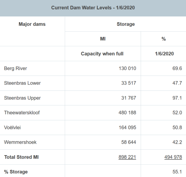
Dam levels are looking promising as they reached 55.1% this week, with Steenbras Upper at 97.1% and Berg River a 69.6.
Picture: Pexels
